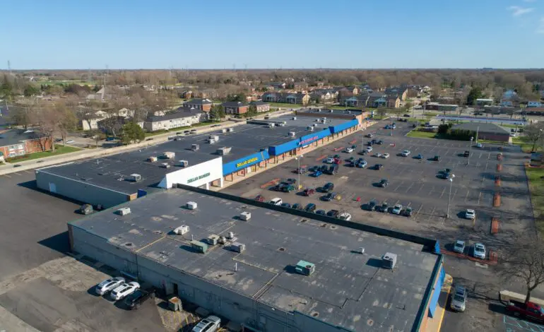
STERLING HEIGHTS – As part of its efforts to revitalize business developments across the city, the Sterling Heights City Council is expected to approve a new ordinance that would broaden the types of businesses permitted to operate within more than 20 commercial plazas and strip malls located at nine key intersections throughout the city.
The proposal, which is anticipated to be approved at the Council’s upcoming meeting on Tuesday, is designed to help strip mall owners fill increasing vacancies caused by years of business closures and departures — especially among pharmacies.
Earlier in May, the Council had unanimously approved the ordinance’s first reading, which reclassifies zoning at certain intersections under a new “Commercial Node” designation. This would allow a wider variety of businesses to open in existing shopping centers, including entertainment venues, hotels, restaurants and even residential housing.
According to City Planner and Development Manager Jake Parcell, the “Commercial Nodes” are divided into two types: “Neighborhood Nodes” and “Area Nodes.” Parcell expects the ordinance to be formally adopted at the next City Council meeting.
Parcell explained that the ordinance “opens the door to uses that we think will attract people”, giving commercial property owners more flexibility and enabling a transformation of the city’s economic landscape. Sterling Heights has a population of about 133,000.
Shopping centers at the targeted intersections vary in size — some can host four or five tenants, while others accommodate between 15 and 20 businesses.
Under the ordinance, the city would create three “Neighborhood Nodes” at less congested intersections surrounded by single-family residential neighborhoods. These are located at:
- Dequindre Road and 17 Mile
- Ryan Road and 17 Mile
- Dodge Park Road and 15 Mile
Six additional, busier intersections would be designated as “Area Nodes”, including:
- Dequindre and 15 Mile
- Ryan and 18 Mile
- Schoenherr and 14 Mile
Parcell stated the ordinance would permit 71 different uses within both types of nodes. These include veterinary clinics, office spaces, garden supply stores, home goods retailers, banquet halls, drive-thru and dine-in restaurants with outdoor seating, hotels, golf, bowling simulators and many more.
The ordinance also allows for the construction of multifamily housing at these intersections. However, any residential project would require review and approval by both the Planning Commission and the City Council.
Located in Macomb County, Sterling Heights is the fourth-largest city in Michigan by population, after Warren, Grand Rapids and Detroit. It spans 36.5 square miles (95 square kilometers).
This commercial revitalization effort coincides with the city’s redevelopment of the Lakeside Mall site into a new downtown district. Demolition is already underway to replace the mall with a massive mixed-use neighborhood featuring residential and office buildings, restaurants, retail stores, a large hotel and a central park.
Also in May, the City Council unanimously approved an update to the Master Land Use Plan, a long-term framework governing future land development and zoning. This move reflects the vision of Mayor Michael Taylor and City Manager Mark Vanderpool to reshape the overall landscape of Sterling Heights — a city home to the largest concentration of Arab and Chaldean communities in the Metro Detroit area outside of Wayne County.


Leave a Reply